Where Is Sandy, Utah?
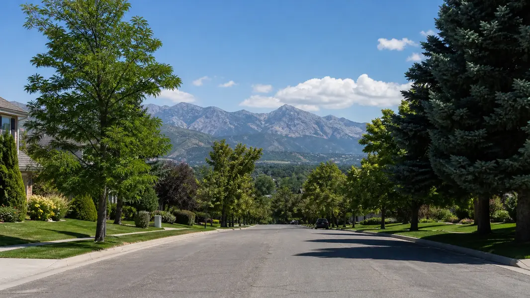
Sandy sits in the southeast corner of the Salt Lake Valley, about 13 miles south of downtown Salt Lake City, with 24.15 square miles of land. Midvale and Cottonwood Heights border it to the north, Draper to the south, and the Jordan River forms part of its western edge with West Jordan and South Jordan. To the east the city climbs the Wasatch bench to Wasatch Boulevard and the unincorporated Granite area at the mouth of Little Cottonwood Canyon. The small city of White City is an enclave surrounded entirely by Sandy.
Most Sandy addresses use ZIP codes 84070, 84092, 84093 or 84094, while 84090 and 84091 are post office box ZIPs. These ZIPs do not follow city limits: 84070 also covers part of Midvale, 84093 reaches into Cottonwood Heights, and 84092 extends to Granite, Alta and Snowbird. Confirm the city on the Salt Lake County parcel record whenever taxes, services or school assignments matter.
What Are the Neighborhoods in Sandy, Utah?
Sandy neighborhoods change from west to east as the land rises. Historic Sandy centers on the Sandy Historic District, listed on the National Register in 2007, about 266 acres between State Street and 700 East from Pioneer Avenue (8530 South) to 9000 South, with buildings dating to 1875. Just south, The Cairns is the city’s planned downtown between 9000 South and 11400 South from I-15 to the TRAX line, home to City Hall, The Shops at South Town and newer apartments near the stations.
The middle of the city is classic 1970s and 1980s Sandy, with subdivisions, parks and schools split by the Dimple Dell ravine. Farther east the bench rises toward Wasatch Boulevard and the Bell Canyon trailhead, with areas around Willow Creek Country Club near 8500 South (some nearby homes are in Cottonwood Heights), Alta Canyon, the gated Pepperwood community near Dimple Dell and Hidden Valley around Hidden Valley Country Club. Listing sites use many subdivision names, so search by map and street.
What Types of Homes Are in Sandy, and What Do They Cost?
Sandy homes are mostly single-family houses built from the 1970s through the 1990s, when Sandy grew from a small town into one of Utah’s largest suburbs. Expect brick and stucco ramblers with full basements, split-levels and two-story traditional homes with mature trees and fenced yards. Historic Sandy adds Victorian-era and early 20th-century cottages and bungalows, townhomes and apartments cluster near TRAX and The Cairns, and east-bench subdivisions near Dimple Dell, Alta Canyon and Hidden Valley hold larger custom homes, many with walkout basements and valley views.
Sandy real estate sits in the upper-middle tier of Salt Lake County, generally above Midvale and Murray for comparable homes and generally below Cottonwood Heights and Draper. Prices rise from west to east: townhomes and original-condition ramblers are the usual entry points, central two-story homes form the middle, and updated east-bench homes with views and trail access sit at the top. For live numbers, check the market stats on this page or ask Jpok Homes for a pricing analysis of a specific address.
Sandy at a glance

04 / Daily life
Is Sandy a Good Place to Live?
Sandy combines established suburban neighborhoods with big-city amenities and fast mountain access. Dimple Dell Regional Park, a 630-acre Salt Lake County natural area, runs east to west through the city with more than 15 miles of trails for hiking, biking and horseback riding, reached from the Wrangler Trailhead at 10350 South 1300 East. The Bell Canyon trail climbs from Wasatch Boulevard to Bell Canyon Reservoir in about half a mile, and the city is rebuilding the Alta Canyon Sports Center, keeping its outdoor pool, with completion expected in early 2027.
Entertainment is close to home. America First Field hosts Real Salt Lake and the Utah Royals, the Sandy Amphitheater at 1245 East 9400 South stages summer concerts, and Hale Centre Theatre performs at the Mountain America Performing Arts Centre. The Shops at South Town, now owned by Smith Entertainment Group, houses the Utah Mammoth practice facility. Trade-offs include busy State Street and 10600 South corridors, event-day traffic near the stadium and winter canyon congestion on the east side.
Dimple Dell Regional Park
630 acres, 15+ miles of trailsBell Canyon Trail
Reservoir about half a mile upAlta Canyon Sports Center
Rebuild targeted for early 2027America First Field
Real Salt Lake and Utah RoyalsSandy Amphitheater
Summer concerts, 1245 E 9400 SHale Centre Theatre
Mountain America Performing Arts CentreThe Shops at South Town
Retail plus Utah Mammoth facilityMountain America Expo Center
Shows and events on State StreetSandy Historic District
National Register district, 1875 on05 / Getting around
Does Sandy Have TRAX, and How Close Are the Ski Resorts?
Sandy has four TRAX Blue Line stations: Historic Sandy at 9000 South, Sandy Expo at about 9400 South, Sandy Civic Center at 10000 South and Crescent View at 11400 South, connecting north to downtown Salt Lake City and south to Draper. I-15 runs along the west side with exits at 9000 South, 10600 South and 11400 South, State Street parallels it, and FrontRunner commuter rail stops in neighboring South Jordan and Draper.
East Sandy is one of the closest valley locations to Little Cottonwood Canyon, where State Route 210 leads to Snowbird and Alta. During the 2025–26 season, UTA ski bus route 994 ran from Historic Sandy Station with a park-and-ride at 9400 South 2000 East. UDOT plans its own canyon bus service, a parking structure and winter tolls for both Cottonwood canyons, targeted for about fall 2028, with the Little Cottonwood gondola a later phase that is not fully funded. Expect a winter traction law and resort parking reservations, and check routes each season.
06 / Schools
What Schools Serve Sandy, Utah?
Canyons School District. Confirm assignments for each address.
Alta High · Jordan High · 5 middle schools
Sandy is in Canyons School District, which has served the city since the 2009–10 school year and has its district office at 9361 South 300 East in Sandy. Alta High and Jordan High are the traditional public high schools inside the city, and Diamond Ridge High also operates there. Middle schools in Sandy are Albion, Eastmont, Indian Hills, Mount Jordan and Union, and there are 17 elementary schools with Sandy addresses, including Alta View, Altara, East Sandy, Granite, Lone Peak, Oakdale, Peruvian Park, Quail Hollow and Willow Canyon.
Brighton · Hillcrest · Corner Canyon
Depending on the address, Sandy students may feed to Brighton High in Cottonwood Heights, Hillcrest High in Midvale or Corner Canyon High in Draper. In December 2025 the board realigned Oakdale’s feeder pattern so Albion feeds Brighton and Union feeds Hillcrest, and moved Quarry Bend north of 9000 South to East Sandy Elementary. In May 2026 it tabled proposals to merge Park Lane with Willow Canyon and Granite with Quail Hollow. Confirm current schools for any home with Canyons School District before you buy.
07 / Compare
Sandy vs. Draper vs. Cottonwood Heights
| Sandy | Draper | Cottonwood Heights | |
|---|---|---|---|
| Incorporated | 1893 | 1978 | 2005 |
| Population (2020) | 96,904 | 51,017 | 33,617 |
| Land area | 24.15 sq mi | 29.95 sq mi | 9.23 sq mi |
| School district | Canyons | Canyons and Alpine | Canyons |
| Rail transit | 4 TRAX stations | 2 TRAX + FrontRunner | None in city |
Sandy vs. Draper: Sandy, incorporated in 1893, had 96,904 residents in the 2020 Census on 24.15 square miles of land, while Draper, incorporated in 1978, had 51,017 residents on about 30 square miles that cross into Utah County. Sandy is largely built out with established 1970s to 1990s neighborhoods and four TRAX stations. Draper grew mostly after 1990, so more of its homes are newer, and it has two TRAX stations, a FrontRunner station and schools split between Canyons and Alpine districts.
Sandy vs. Cottonwood Heights: both are in Canyons School District and share the east bench near Little Cottonwood Canyon. Cottonwood Heights, incorporated in 2005, is smaller, with 33,617 residents on about 9.2 square miles, mostly residential and without a TRAX station. Sandy offers a wider range of price points, more shopping and entertainment and rail transit, while Cottonwood Heights homes carry a premium for views and proximity to both canyon mouths.

08 / Buying
Tips for Buying a Home in Sandy
Buying a home in Sandy goes smoothest when you pick your zone, verify schools and inspect for the age of the house.
Get pre-approved
Have a lender letter ready before touring so you can act on updated homes quickly.
Pick your zone
Decide between west-side TRAX access, central subdivisions or east-bench views and trails.
Check the city
Confirm on the county parcel record that the home is inside Sandy, not White City or Granite.
Verify schools
Look up current Canyons School District assignments for the exact address.
Tour and compare
Compare homes by era, lot slope and drive times to TRAX, I-15 and the canyon.
Inspect fully
Order a full inspection and sewer scope, focusing on roof, furnace, panel and basement.
Test for radon
Test every home, especially on the east bench near Little Cottonwood Canyon.
Review the rules
Check permits for basement apartments and any ADU or rental plans with the city.
Close and move in
Finalize financing, title and walkthrough, then set up Sandy City utilities.
Scroll for all 9 →

09 / Selling
Selling a Home in Sandy: What Buyers Pay For
Selling a home in Sandy starts with pricing against the right micro-market, because a Historic Sandy cottage, a central rambler near Alta High and an east-bench view home off Wasatch Boulevard draw different buyers. Sandy buyers pay most for updated kitchens and baths, finished basements with separate entrances, newer roofs and HVAC, oversized or three-car garages, usable yards, views and short drives to Dimple Dell trails, TRAX and Little Cottonwood Canyon.
Before listing, consider a pre-inspection and sewer scope, gather records for roof, furnace and electrical work, and have a radon test result ready, especially on the east bench. If the home has a permitted accessory apartment, note that Sandy’s permit does not transfer, so a buyer must reapply. Shoot photography on a clear day or at twilight to capture mountain and valley views, price from street-level comparable sales rather than citywide averages, and give buyers accurate Canyons School District information with a note to verify.
What buyers look for
- Updated kitchens
- Finished basements
- Newer roof and HVAC
- Three-car garages
- Mountain views
- Near Dimple Dell
- TRAX access
- Radon test on file
10 / Jpok Homes
Work With a Sandy Real Estate Expert
Sandy is large enough that pricing shifts by neighborhood, era and elevation, so local guidance pays off whether you are moving to Sandy or selling a home you have owned for decades. Jpok Homes, with Signature Group Real Estate, works throughout Sandy from the brokerage’s office at 7650 South Union Park Avenue in Midvale, a short drive north of the Sandy city line.
If you are buying, ask for a custom search of Sandy homes for sale and alerts for new listings that match your neighborhood, school, TRAX or canyon-access priorities. If you are selling, request a free home valuation built on recent Sandy comparable sales, plus a preparation, pricing and marketing plan for your home. Call Jpok Homes at (801) 550-8250 to schedule a tour or a no-obligation conversation about your next move in Sandy.
Featured Listings
 Price Dropped by $25K
 Price Dropped by $112K
 Open Sat 12PM-1PM
 Open Wed 9AM-7PM
 Open Sat 11AM-1PM
 Open Sat 12PM-3PM
Questions & answers
Sandy Real Estate FAQs
The questions buyers and sellers ask most about living in, buying in, and selling in Sandy, Utah.
Where is Sandy, Utah?
Sandy, Utah is a city in southeast Salt Lake County, about 13 miles south of downtown Salt Lake City. It borders Midvale and Cottonwood Heights to the north and Draper to the south, with the Jordan River along part of its west side and the Wasatch foothills near Little Cottonwood Canyon to the east. Sandy covers about 24 square miles of land.
Is Sandy, Utah a good place to live?
Sandy, Utah offers established suburban neighborhoods with strong amenities and mountain access. The city has Dimple Dell Regional Park’s 630 acres of trails, four TRAX stations, America First Field, The Shops at South Town and quick access to Little Cottonwood Canyon’s ski resorts. Trade-offs include busy arterial roads, event-day traffic near the stadium and winter canyon congestion on the east side.
What ZIP codes are in Sandy, Utah?
Sandy, Utah home addresses use ZIP codes 84070, 84092, 84093 and 84094, and 84090 and 84091 are post office box ZIPs. These ZIPs do not match Sandy city limits: 84070 also covers part of Midvale, 84093 reaches into Cottonwood Heights, and 84092 extends to Granite, Alta and Snowbird. Check the Salt Lake County parcel record to confirm a property’s city.
What school district is Sandy, Utah in?
Sandy, Utah is in Canyons School District, which has served the city since 2009. Alta High and Jordan High are inside Sandy, along with Albion, Eastmont, Indian Hills, Mount Jordan and Union middle schools and 17 elementary schools with Sandy addresses. Some Sandy addresses feed Brighton, Hillcrest or Corner Canyon high schools, so confirm current assignments for any home with the district.
Does Sandy, Utah have TRAX?
Yes. Sandy, Utah has four TRAX Blue Line stations: Historic Sandy at 9000 South, Sandy Expo at about 9400 South, Sandy Civic Center at 10000 South and Crescent View at 11400 South. The Blue Line connects Sandy to downtown Salt Lake City and Draper, and FrontRunner commuter rail stops in neighboring South Jordan and Draper.
How close is Sandy, Utah to the ski resorts?
East Sandy, Utah is one of the closest Salt Lake Valley areas to Little Cottonwood Canyon, where State Route 210 leads to Snowbird and Alta. In the 2025–26 season, UTA ski bus route 994 ran from Historic Sandy Station. UDOT plans expanded canyon buses and winter tolls around 2028, so check current routes, traction rules and resort parking reservations each winter.
When was Sandy, Utah founded?
Sandy, Utah was settled in 1871 and incorporated as a city in 1893. A railroad reached the town in 1873, and silver mining in Little Cottonwood Canyon made Sandy a supply and smelting center, with the Flagstaff, Mingo and Saturn smelters. Its historic core, the Sandy Historic District, was listed on the National Register of Historic Places in 2007.
What types of homes are in Sandy, Utah?
Sandy, Utah homes are mostly single-family ramblers, split-levels and two-story homes built from the 1970s through the 1990s, many with full basements and mature yards. Historic Sandy has older cottages and bungalows, townhomes and apartments cluster near TRAX and The Cairns, and east-bench areas near Dimple Dell, Alta Canyon and Hidden Valley hold larger custom view homes.
Are homes in Sandy more expensive than in Midvale or Draper?
Sandy, Utah home prices generally fall in the upper-middle tier of Salt Lake County, usually above Midvale and Murray for comparable homes and generally below Draper and Cottonwood Heights. Within Sandy, prices rise from west to east, with updated east-bench homes near Dimple Dell, Alta Canyon and Hidden Valley at the top and townhomes and original ramblers as entry points.
What is Dimple Dell Regional Park?
Dimple Dell Regional Park is a 630-acre Salt Lake County natural area that runs east to west through Sandy, Utah. It has more than 15 miles of trails for hiking, bicycling and horseback riding, with trailheads at Wrangler (10350 South 1300 East), Dimple Dell Road and Mount Jordan Road. Homes along its edges are valued for trail access and open-space views.
Can I add an ADU or run a short-term rental in Sandy, Utah?
Sandy, Utah allows one internal accessory apartment inside an owner-occupied single-family home, with an administrative special use permit and a business license, and the permit does not transfer on sale. Short-term rentals require city permits and a business license, and eligibility rules apply. Confirm current rules for a specific Sandy property with Sandy Community Development.
What should I inspect when buying a home in Sandy, Utah?
When buying a Sandy, Utah home, order a full inspection and sewer lateral scope, and check the roof, furnace, water heater, electrical panel and basement moisture, since many homes date from the 1970s to 1990s. Test for radon, especially on the east bench near Little Cottonwood Canyon, review Wasatch Fault hazard maps and confirm that basement finishes were permitted.